Contour
Precision Farming for Sustainable Agriculture
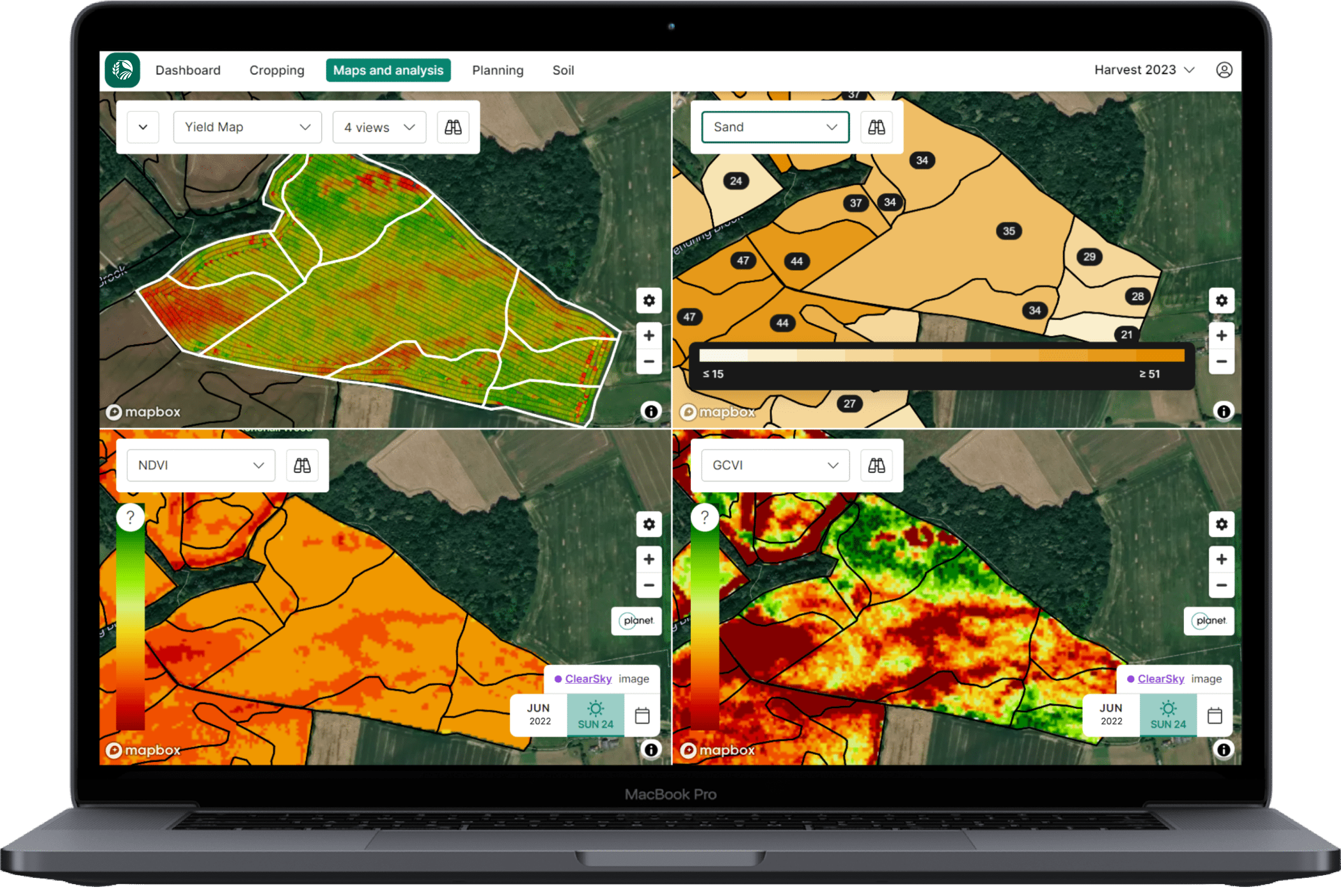
Contour is our cutting-edge precision agriculture tool that empowers farmers to optimise input efficiency, streamline compliance, and boost yields through sustainable field plans. With Contour, farmers and advisors can identify issues early, apply products precisely, and maximise farm performance and profits.
Precision & Environmental Advisory
Contour uses enriched data from various sources to enable deep analysis and support environmentally friendly decisions:
Hyper-local Weather Data:
Advanced weather models offer temperature, wind speed, soil moisture, soil temperature, and field accessibility metrics.
Satellite Imagery:
High-resolution NDVI & GCVI imagery for better in-field decision-making.
Soil Variability Mapping:
Understand each field with soil variation maps derived from satellite imagery, EC scanning, and topography.
Disease models:
Analyse and predict pressure to inform product applications and reduce waste & overuse.
Yield Maps:
Detailed yield distribution data for trend analysis and land performance assessment.
Cropping & Observation Data:
Access the history of every field whenever needed.
Advanced Soil Analysis
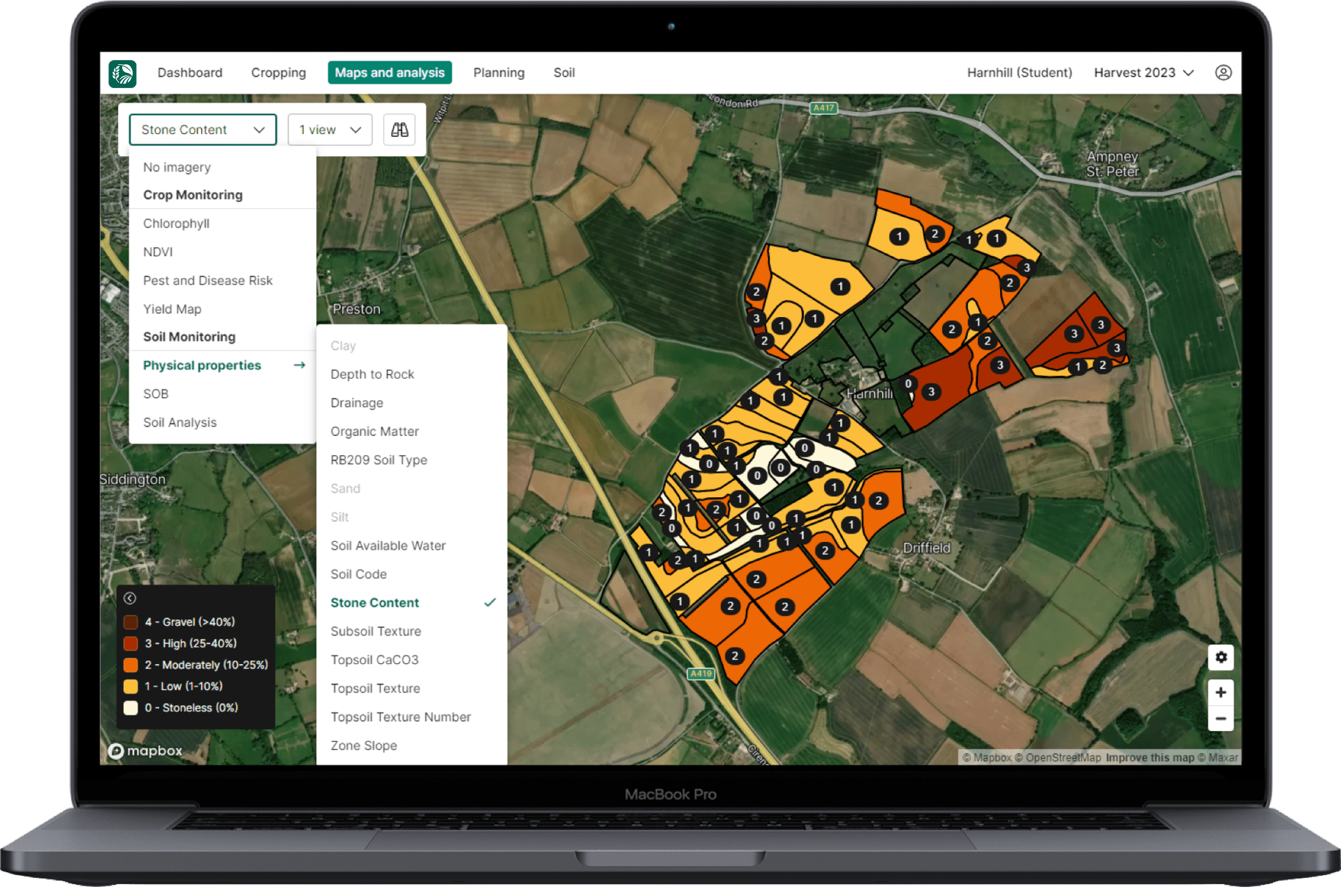
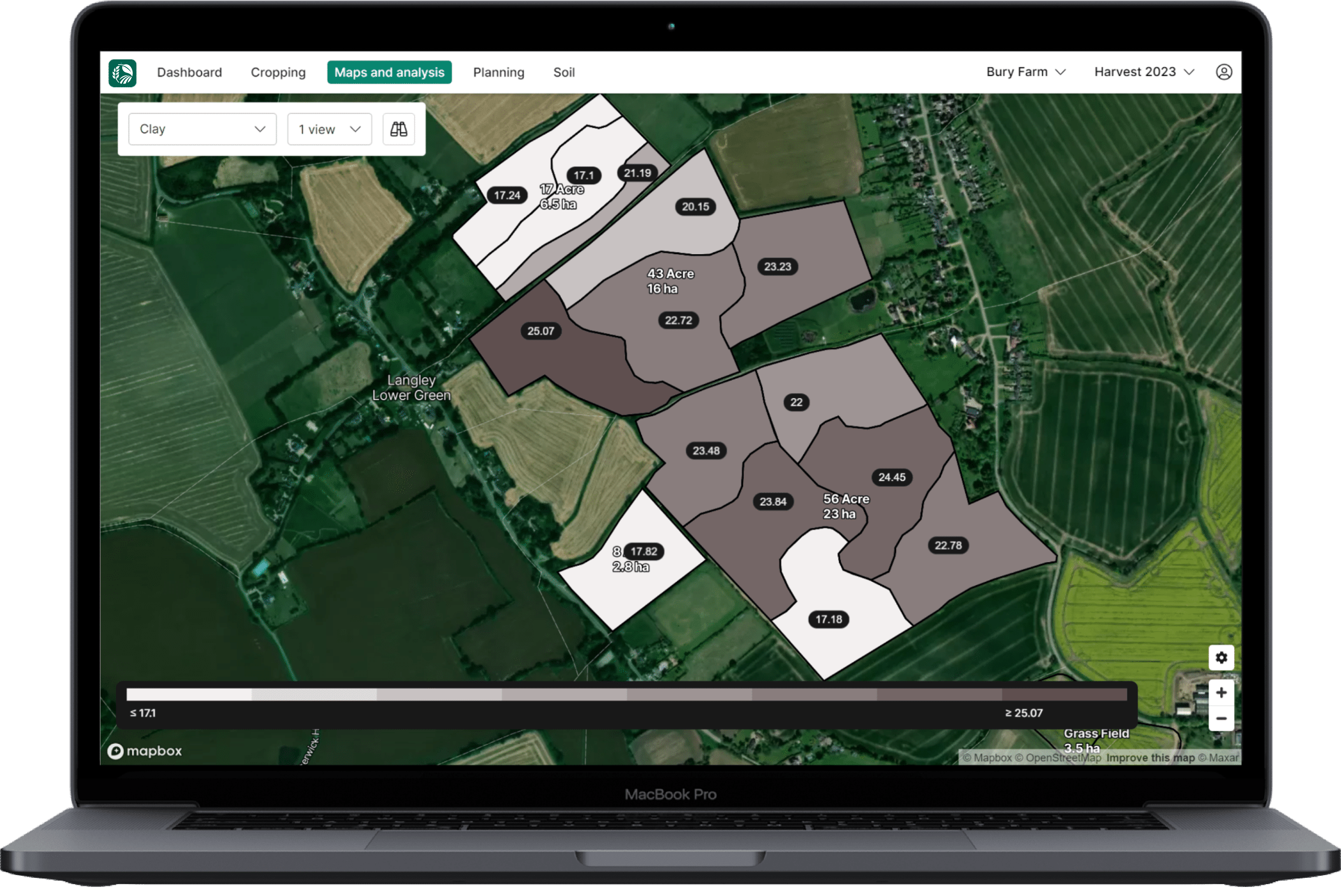
Contour enables analysis of detailed soil information against imagery and yield data to aid management decisions and help determine cause & effect, including:


Essential Nutrient Levels
View P, K, Mg, and pH readings by zone in each field.
Soil Texture
Access data on clay, sand, and silt percentages to better understand soil structure.
Stone Content
Evaluate stone content to inform field management decisions.
Organic Matter
Assess organic matter content to gauge soil health and fertility.
Slope
Examine slope data for efficient water and nutrient management.
Soil Code
Identify soil types using soil codes for better field management and planning.
Depth to Rock
Determine the depth to rock for optimal root growth and soil management strategies.
Drainage
Analyse drainage information to inform irrigation and field management practices.
Soil Available Water
Evaluate soil available water capacity for effective water management and crop health.
Contour Mobile: Fast, Precise Scouting On-the-Go
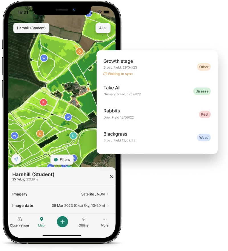
Our award-winning app, Contour Mobile, connects growers and advisors to enable quick, comprehensive observation and recording of field issues.
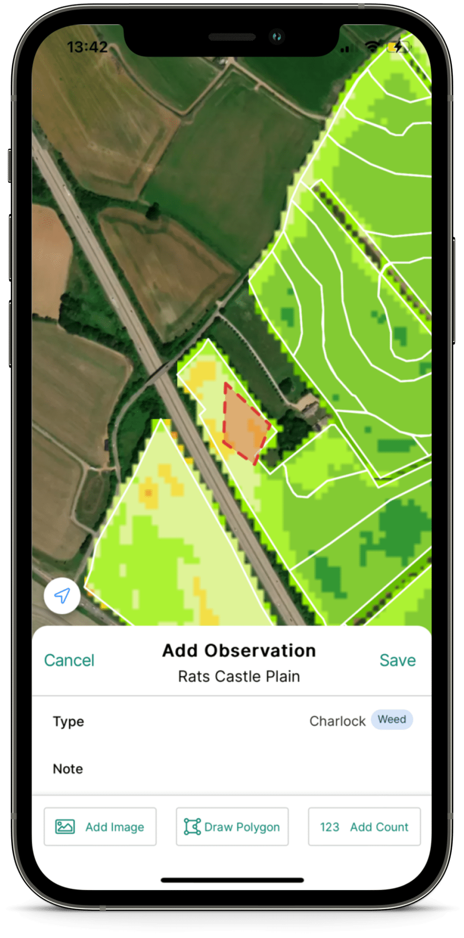
Make Observations
Mark exactly what's going on, when and where. Take and store photos of pest and disease pressure
Draw Polygons
Map affected areas quickly and easily.
GPS Location
Pinpoint exact locations using GPS.
Powerful Data
Compare field conditions and observations against Satellite Imagery, Soil Mapping & Analysis, and Cropping & Observation Data - available even without a network connection.
Offline Functionality
No reception, no problem. Observations will sync to the cloud when you next have signal
Sync to Contour
Observations & analysis sync back to Contour, ready to be used in planning.
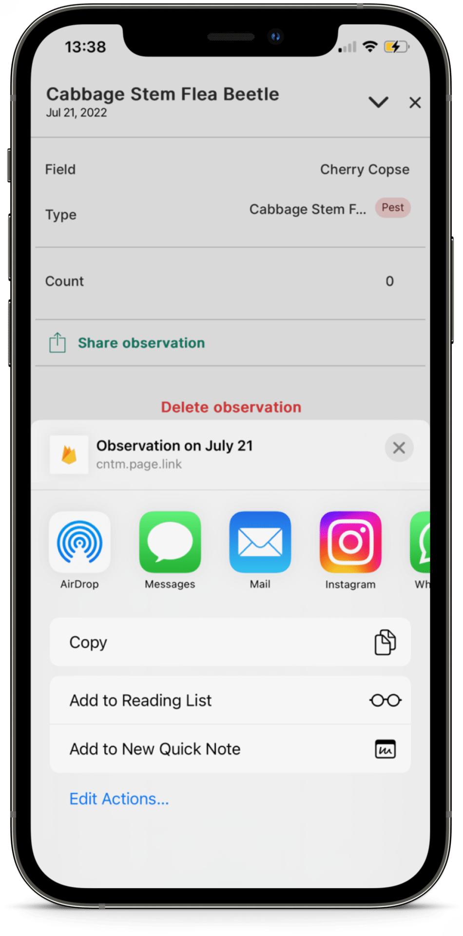
Share with the Team
Share your observations with your network on your preferred messaging platform.
“Observations are a really useful record, I use them to show our growers why we recommend certain prescriptions.”
– Iain Sanderson, Agronomist, Agrii UK
“Observations are a really useful record, I use them to show our growers why we recommend certain prescriptions.”
– Iain Sanderson, Agronomist, Agrii UK
Contour Mobile: Fast, Precise Scouting On-the-Go
Our award-winning app, Contour Mobile, connects growers and advisors to enable quick, comprehensive observation and recording of field issues.
“Observations are a really useful record, I use them to show our growers why we recommend certain prescriptions.”
– Iain Sanderson, Agronomist, Agrii UK
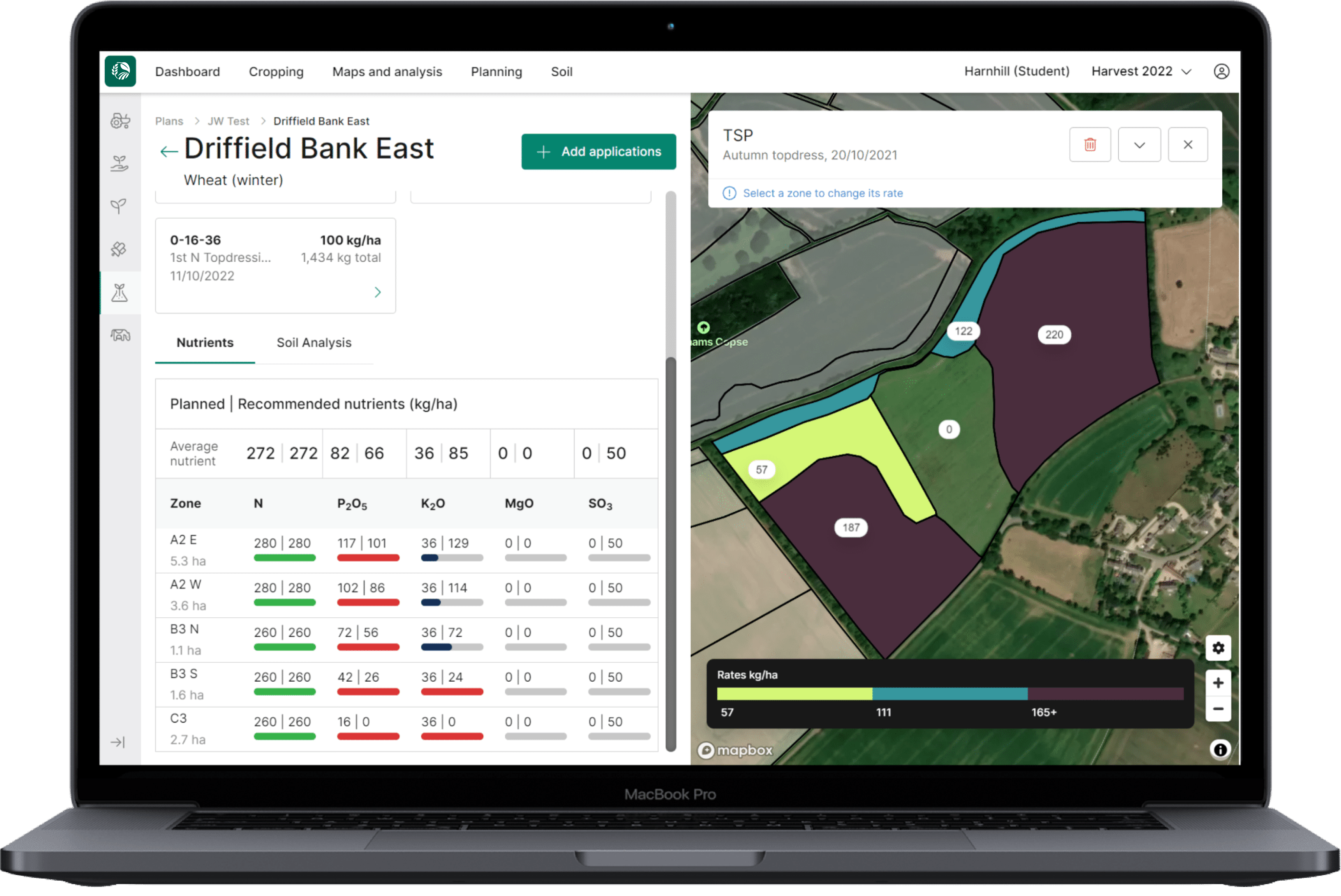

Inputs Optimisation
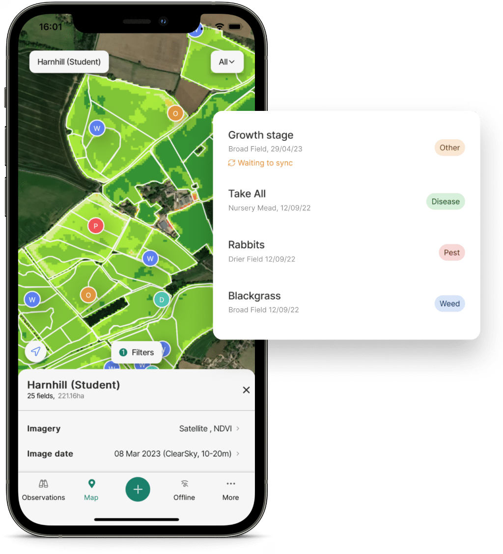

Agronomy Services
Contour’s Agronomy Services tools are designed to optimise agronomy practices, including scouting, farm performance analysis, and crop protection advisory.
Our comprehensive suite of tools and features enables targeted agronomy, promotes collaboration and trust between farmers and advisors, and fosters data-driven decision-making for sustainable and profitable farming.
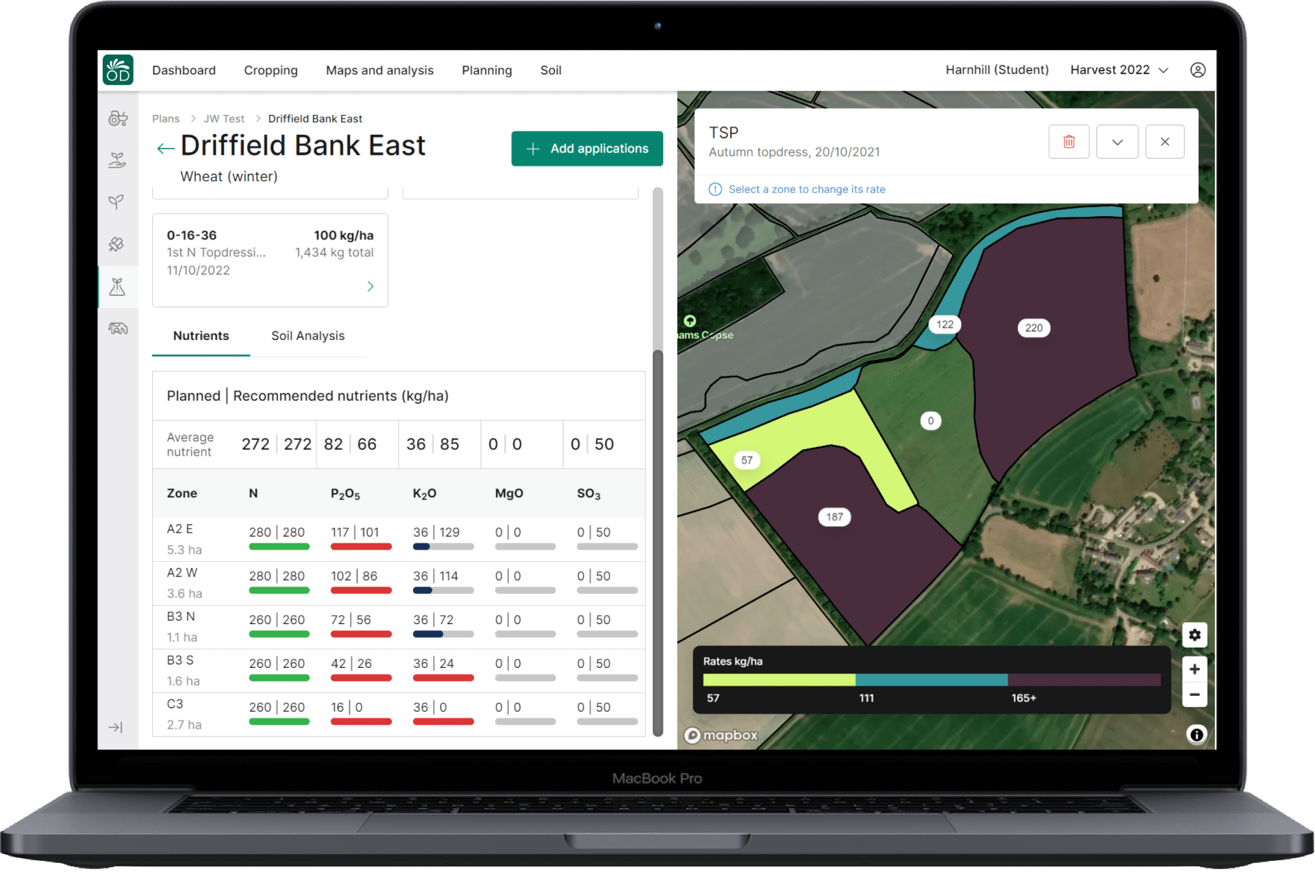
Inputs Optimisation
Contour's Seed, Nutrient, and Compliance Planning tools are designed to optimise performance with tailored recommendations, boosting efficiency to help maximise farm profitability. Our intelligent solutions foster engagement between growers and advisors while driving sustainable farm performance, streamlining compliance, and reducing environmental impacts.

Inputs Optimisation
Contour's Seed & Nutrient Planning tools elevate performance with tailored recommendations, boosting efficiency to help maximise farm profitability. Our intelligent solutions foster engagement between growers and advisors while driving sustainable farm performance, streamlining compliance, and reducing environmental impacts.
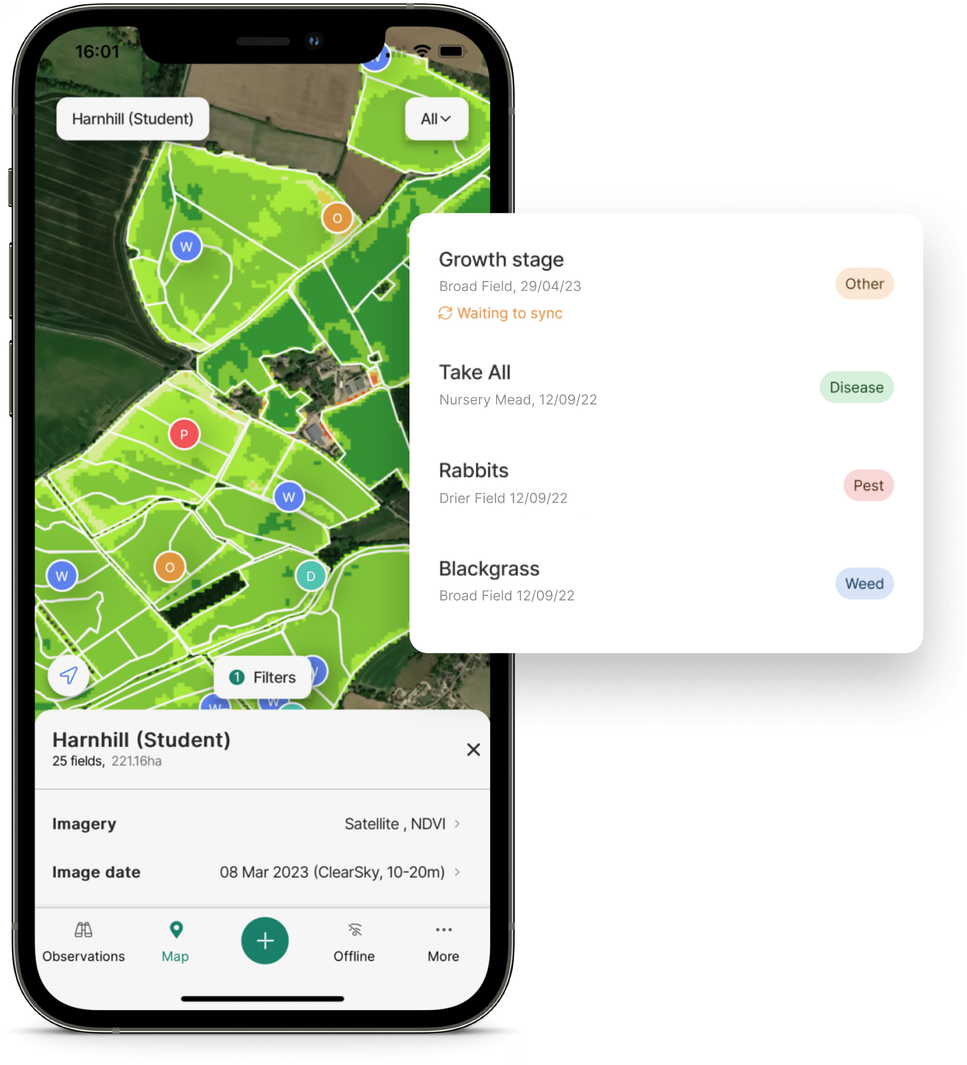
Agronomy Services
Contour’s Agronomy Services tools are designed to optimise agronomy practices, including scouting, farm performance analysis, and crop protection advisory. Our comprehensive suite of tools and features enables targeted agronomy, promotes collaboration and trust between farmers and advisors, and fosters data-driven decision-making for sustainable and profitable farming.
Agronomy Services
Contour's Agronomy Services tools provide comprehensive solutions for effective agronomy practices, targeted scouting, and data-driven decision-making. With innovative features like Contour Mobile, ClearSky Imagery, and built-in pest & disease tools, our platform fosters collaboration and empowers advisors to drive sustainable, profitable farming.

