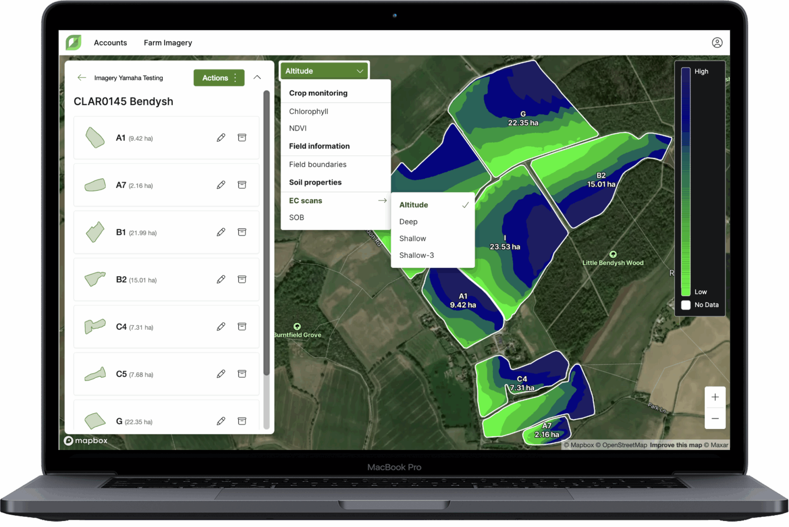
GROW: Admin Portal 2.2: Map imagery layers in Farm management
|
|
Here’s how it benefits you: We’ve made it easier to locate fields when managing larger farms. Scanning through long field…
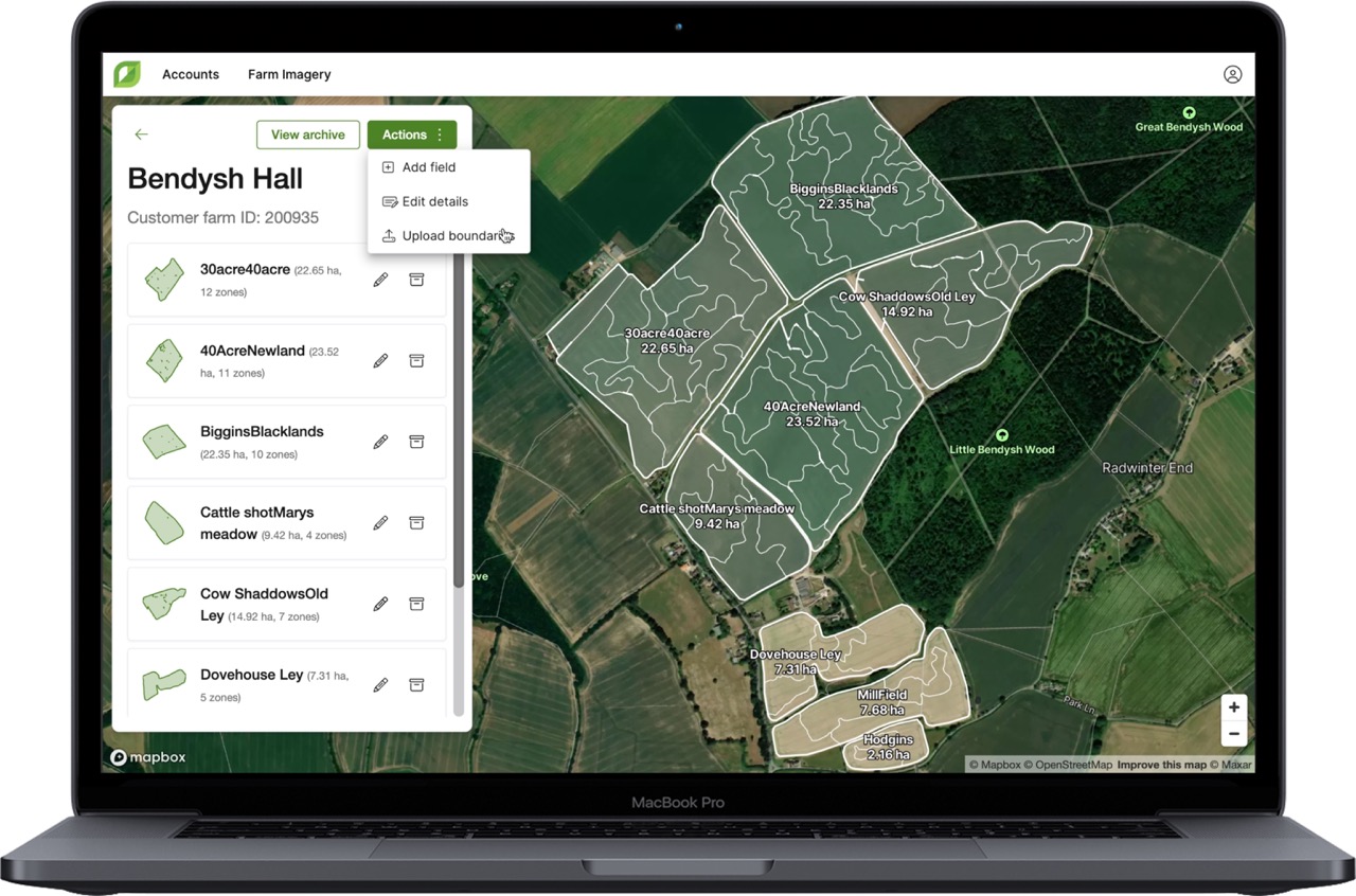
We’re excited to announce the launch of the new Farm Management area in Grow, now live with Admin Portal release…
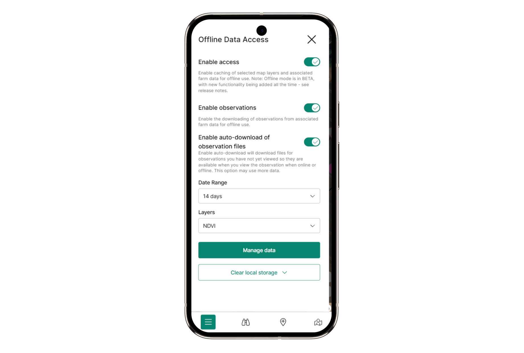
With more and more observations created on Contour mobile, and observation types now available for all SFI actions, being able…
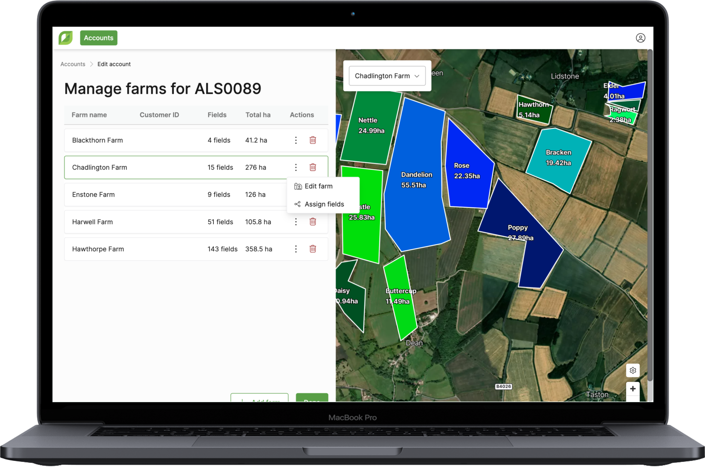
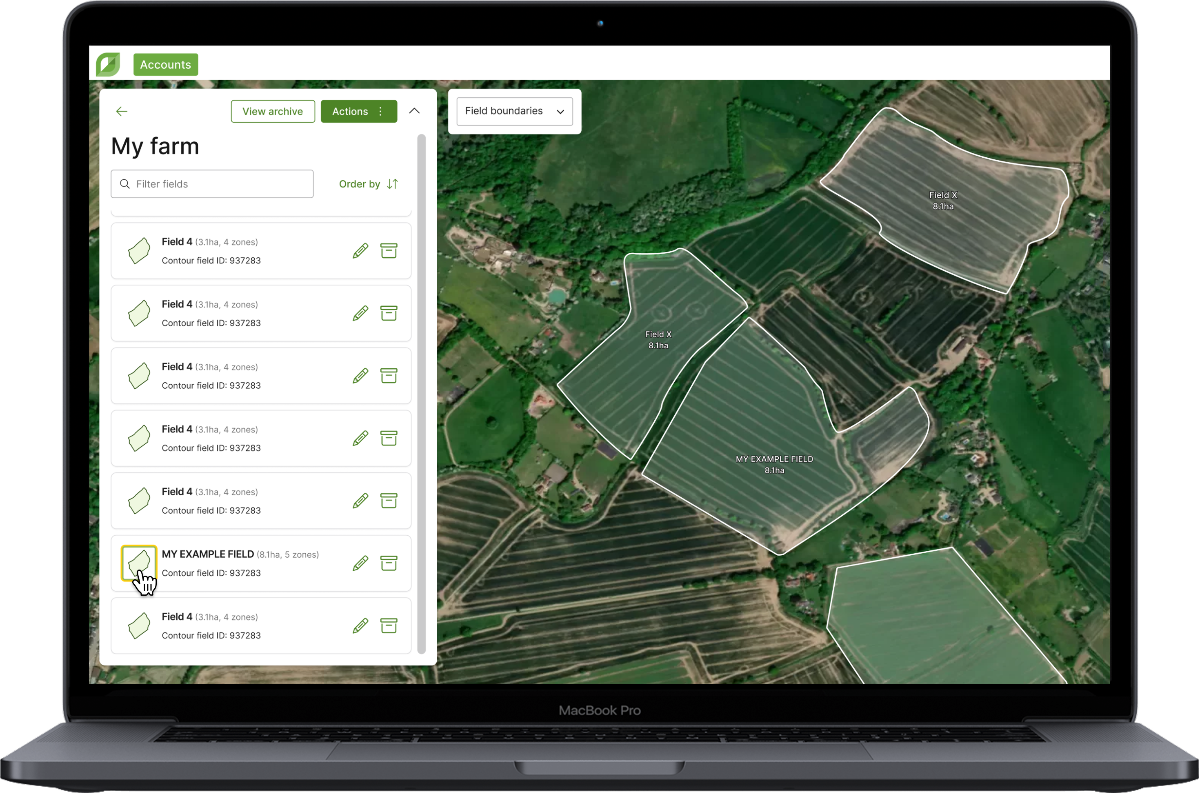
Assign fields, editable zone names and editable field IDs In today’s update you can now assign fields from one farm…
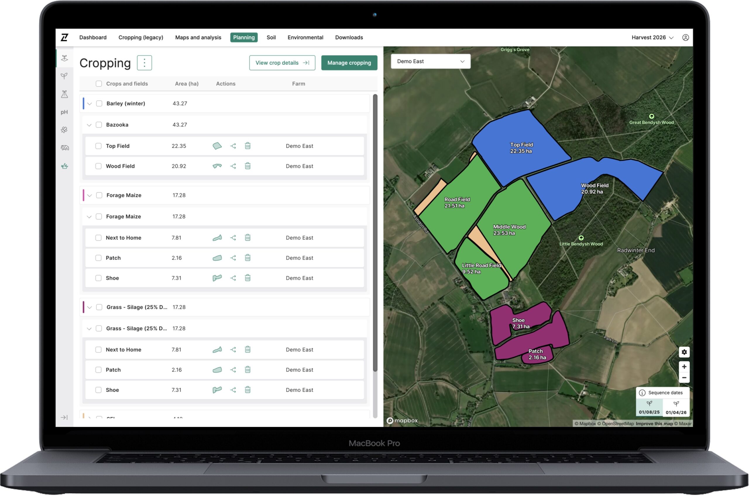
Historically, cropping in Contour was restrictive — allowing only one crop per field and harvest year. This created challenges when…
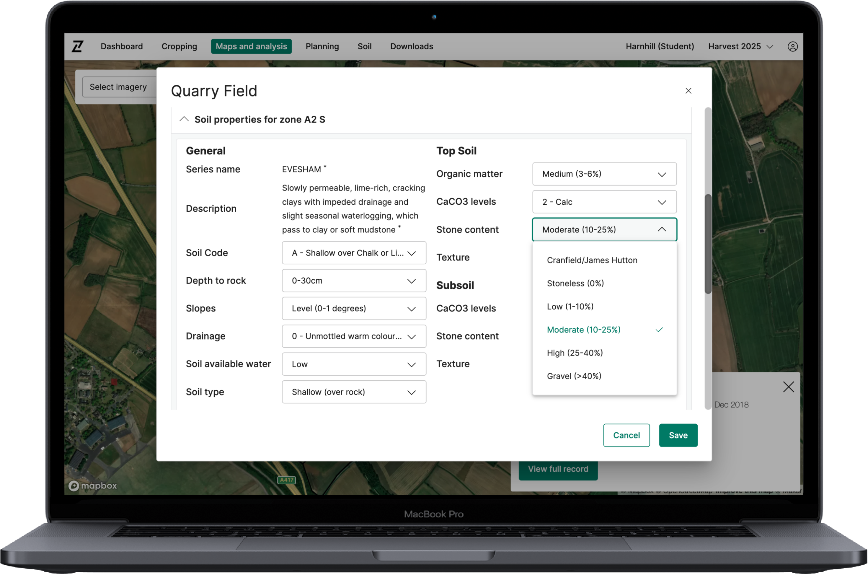
Today’s update to Contour enables users to update the physical soil properties of their fields and zones, helping to more…
3.1. The primary purpose of using Cookies at Origin Digital is to provide an optimised user experience. Cookies help us tailor our Services to your needs and preferences. In this section, we outline some overarching Cookie Policy principles and describe the general types of Cookies we may use. This section will give you a better understanding of how we use Cookies generally to enhance your experience in our Services.
| Analytics Cookie Name | Expiration Duration | Description | Purpose |
|---|---|---|
|
_gcl_au |
3 months |
Google Tag Manager sets the cookie to experiment advertisement efficiency of websites using their services. |
|
-ga_* |
365 Days |
Google Analytics sets this cookie to store and count page views. |
|
-ga |
365 Days |
Google Analytics sets this cookie to calculate visitor, session and campaign data and track site usage for the site’s analytics report. |
| Strictly Necessary Cookie Name | Description | Purpose |
|---|---|
|
– |
– |
| Analytics Cookie Name | Expiration Duration | Description | Purpose |
|---|---|---|
|
_gcl_au |
3 months |
Google Tag Manager sets the cookie to experiment advertisement efficiency of websites using their services. |
|
-ga_* |
365 Days |
Google Analytics sets this cookie to store and count page views. |
|
-ga |
365 Days |
Google Analytics sets this cookie to calculate visitor, session and campaign data and track site usage for the site’s analytics report. |
| Functional Cookie Name | Expiration Duration | Description | Purpose |
|---|---|---|
|
– |
– |
– |
| Targeting Cookie Name | Expiration Duration | Description | Purpose |
|---|---|---|
|
– |
– |
– |
| Social Media Cookie Name | Expiration Duration | Description | Purpose |
|---|---|---|
|
– |
– |
– |
© 2026 Origin Enterprises Digital Limited