
Soil Management Plans in Contour
|
|

|
|

|
|

|
|
|

|
|
|
|
|
|
|
|
|
|
|
|
|
|
|
|
|
|
|
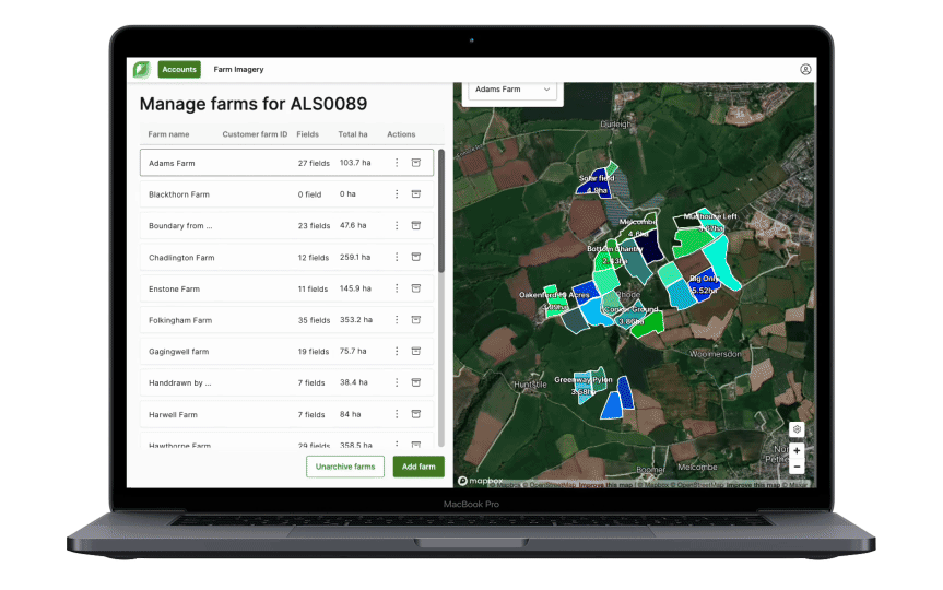
Here’s how it benefits you: Manage all farms and fields in one place with a modern interface. These enhanced tools make it…
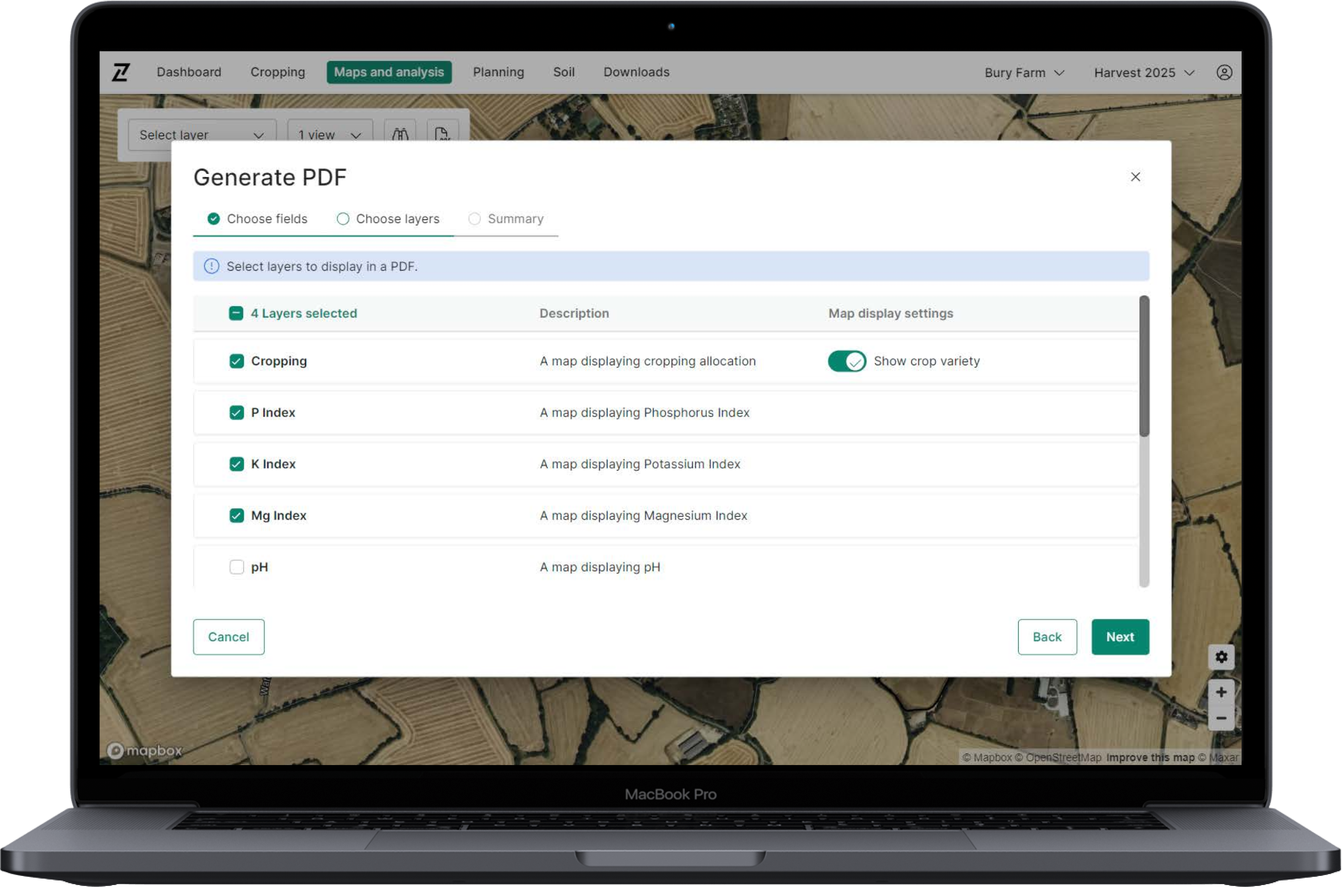
Today’s update to Contour enables users to export a number of maps and analysis layers as PDF reports, helping to…
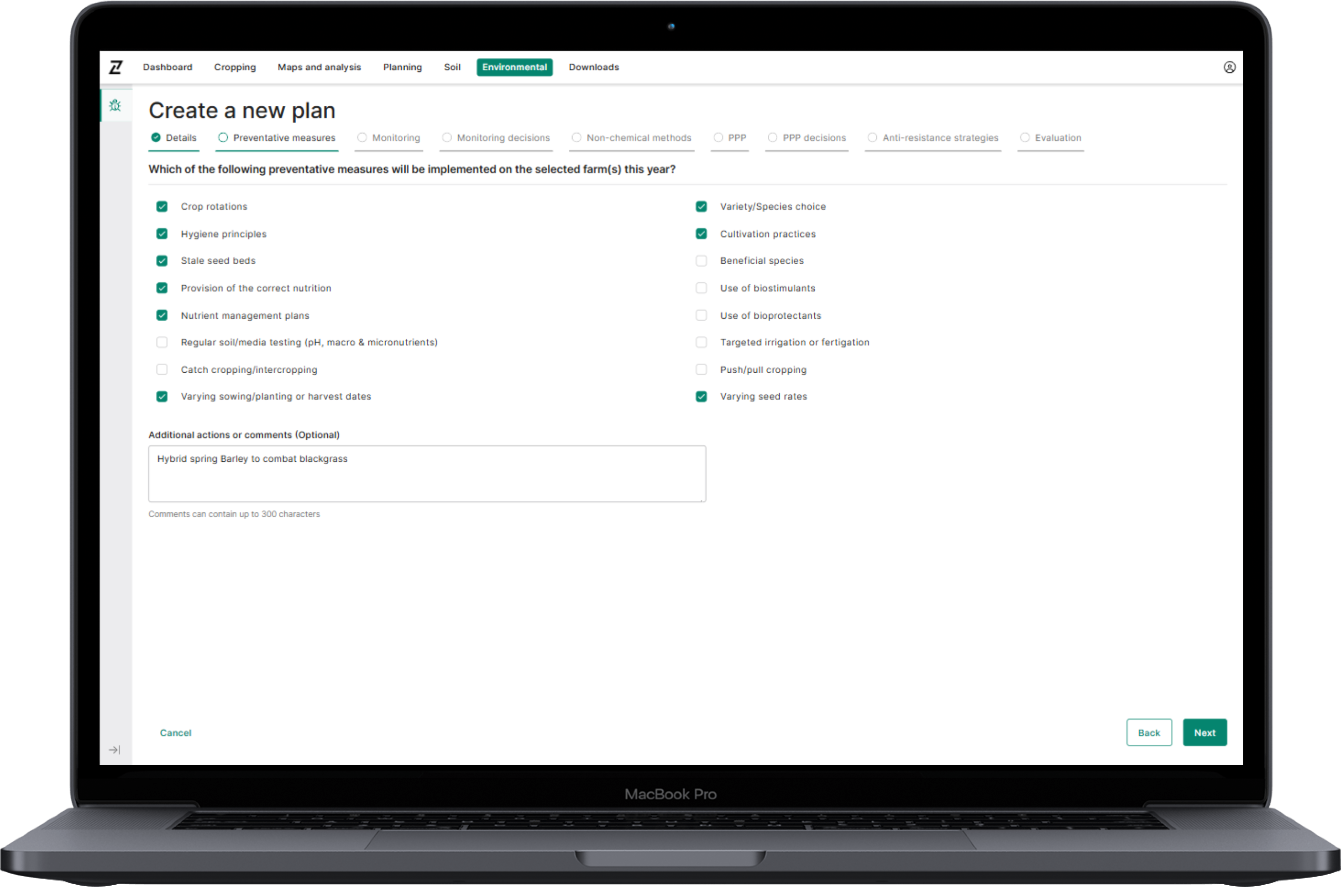
Today’s update is the launch of our Integrated Pest Management planning tool in Contour. The options in the plan cover…
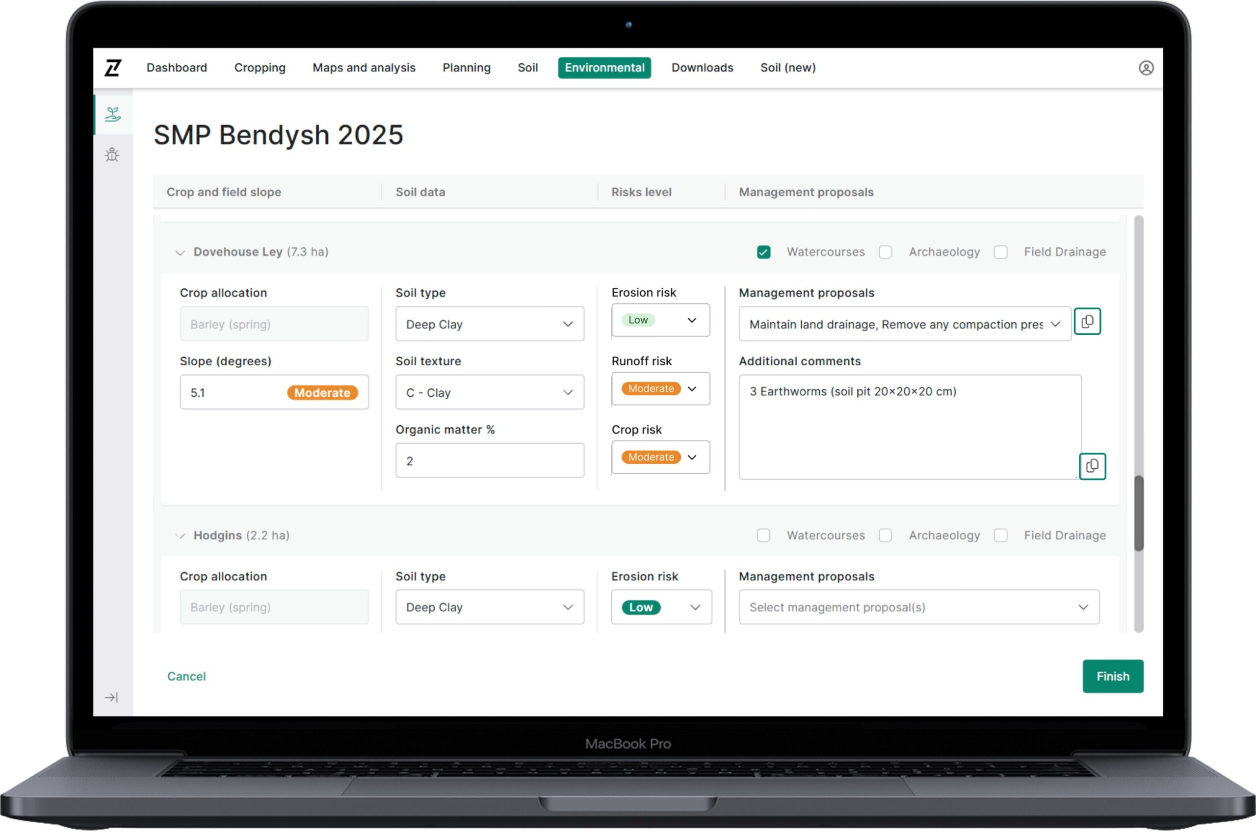
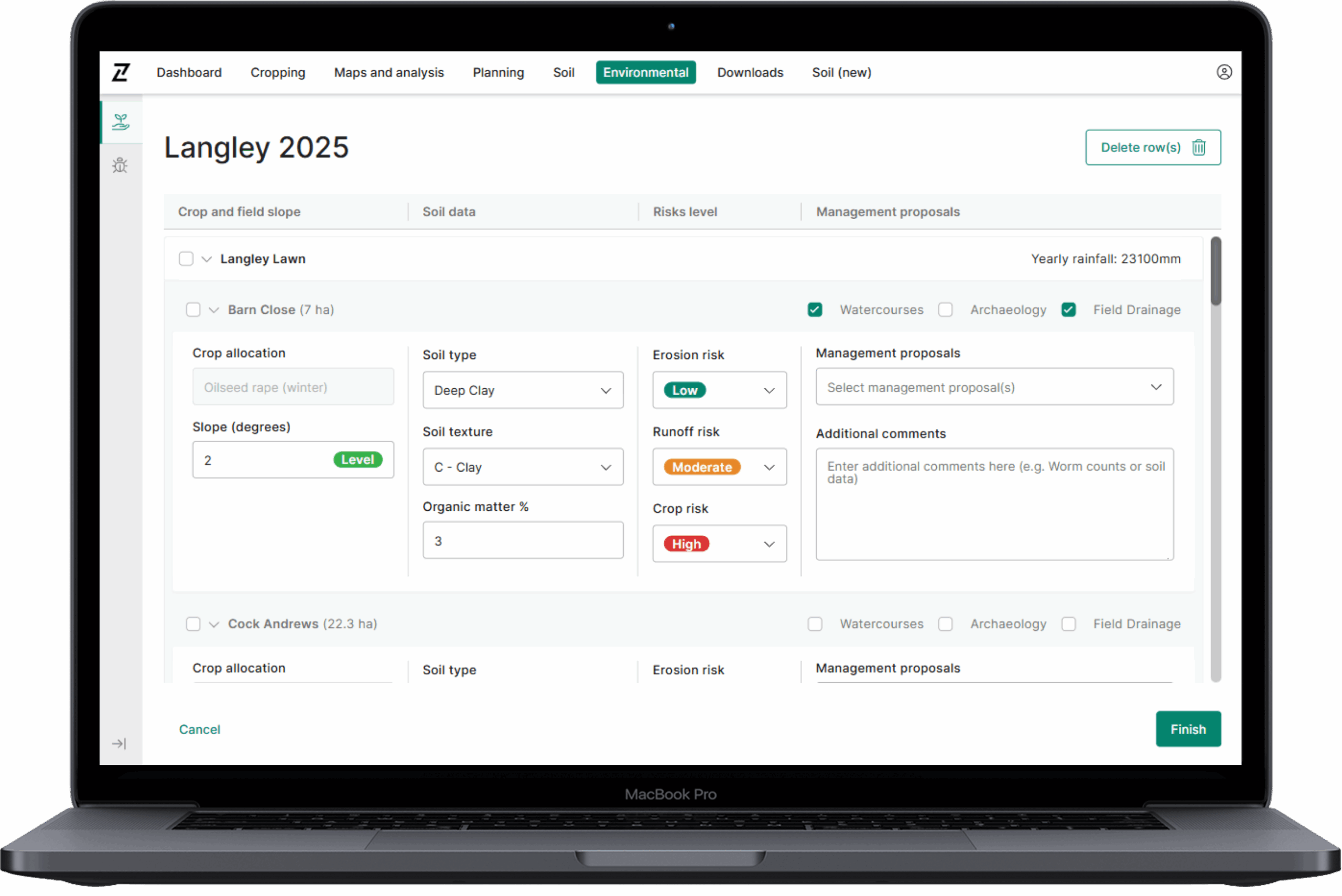
In order to facilitate the quick creation of Soil Management Plans in Contour, particularly across large field groups, this Contour…
Usability improvements and optimisations In this release we have made a number of improvements to Maps and analysis, and its…
Here’s how it benefits you: When uploading boundaries to new or empty fields, you can now choose whether to create zoned…
3.1. The primary purpose of using Cookies at Origin Digital is to provide an optimised user experience. Cookies help us tailor our Services to your needs and preferences. In this section, we outline some overarching Cookie Policy principles and describe the general types of Cookies we may use. This section will give you a better understanding of how we use Cookies generally to enhance your experience in our Services.
| Analytics Cookie Name | Expiration Duration | Description | Purpose |
|---|---|---|
|
_gcl_au |
3 months |
Google Tag Manager sets the cookie to experiment advertisement efficiency of websites using their services. |
|
-ga_* |
365 Days |
Google Analytics sets this cookie to store and count page views. |
|
-ga |
365 Days |
Google Analytics sets this cookie to calculate visitor, session and campaign data and track site usage for the site’s analytics report. |
| Strictly Necessary Cookie Name | Description | Purpose |
|---|---|
|
– |
– |
| Analytics Cookie Name | Expiration Duration | Description | Purpose |
|---|---|---|
|
_gcl_au |
3 months |
Google Tag Manager sets the cookie to experiment advertisement efficiency of websites using their services. |
|
-ga_* |
365 Days |
Google Analytics sets this cookie to store and count page views. |
|
-ga |
365 Days |
Google Analytics sets this cookie to calculate visitor, session and campaign data and track site usage for the site’s analytics report. |
| Functional Cookie Name | Expiration Duration | Description | Purpose |
|---|---|---|
|
– |
– |
– |
| Targeting Cookie Name | Expiration Duration | Description | Purpose |
|---|---|---|
|
– |
– |
– |
| Social Media Cookie Name | Expiration Duration | Description | Purpose |
|---|---|---|
|
– |
– |
– |
© 2026 Origin Enterprises Digital Limited
