
Agronomy Services
Enhancing Farm Performance through Empowering Advisors
Contour’s Agronomy Services tools are designed to optimise agronomy practices, including scouting, farm performance analysis, and crop protection advisory.
Our comprehensive suite of tools and features enables targeted agronomy, promotes collaboration and trust between farmers and advisors, and fosters data-driven decision-making for sustainable and profitable farming:

Integrated Pest Management
Support IPM strategies through rotation management, targeted scouting and advanced risk models that enable proactive crop management.
Targeted Agronomy
Contour Mobile helps advisors to focus on critical areas, maximising their time, expertise impact, and the area they can service.
Secure Soil Data
Organised record-keeping for easy access, analysis, and data-driven remedial action.
Collaborative Scouting
Contour Mobile fosters streamlined communication between farmers and advisors, enabling rapid issue resolution.
Performance Discussions
Contour’s agronomy tools facilitate informed conversations and decision-making on business performance, land management, and benchmarking.
Land Assessment
Yield maps and satellite imagery provide a clear understanding of land performance, guiding resource allocation and management decisions.
Targeted Agronomy
Contour Mobile helps advisors to focus on critical areas, maximising their time, expertise impact, and the area they can service.
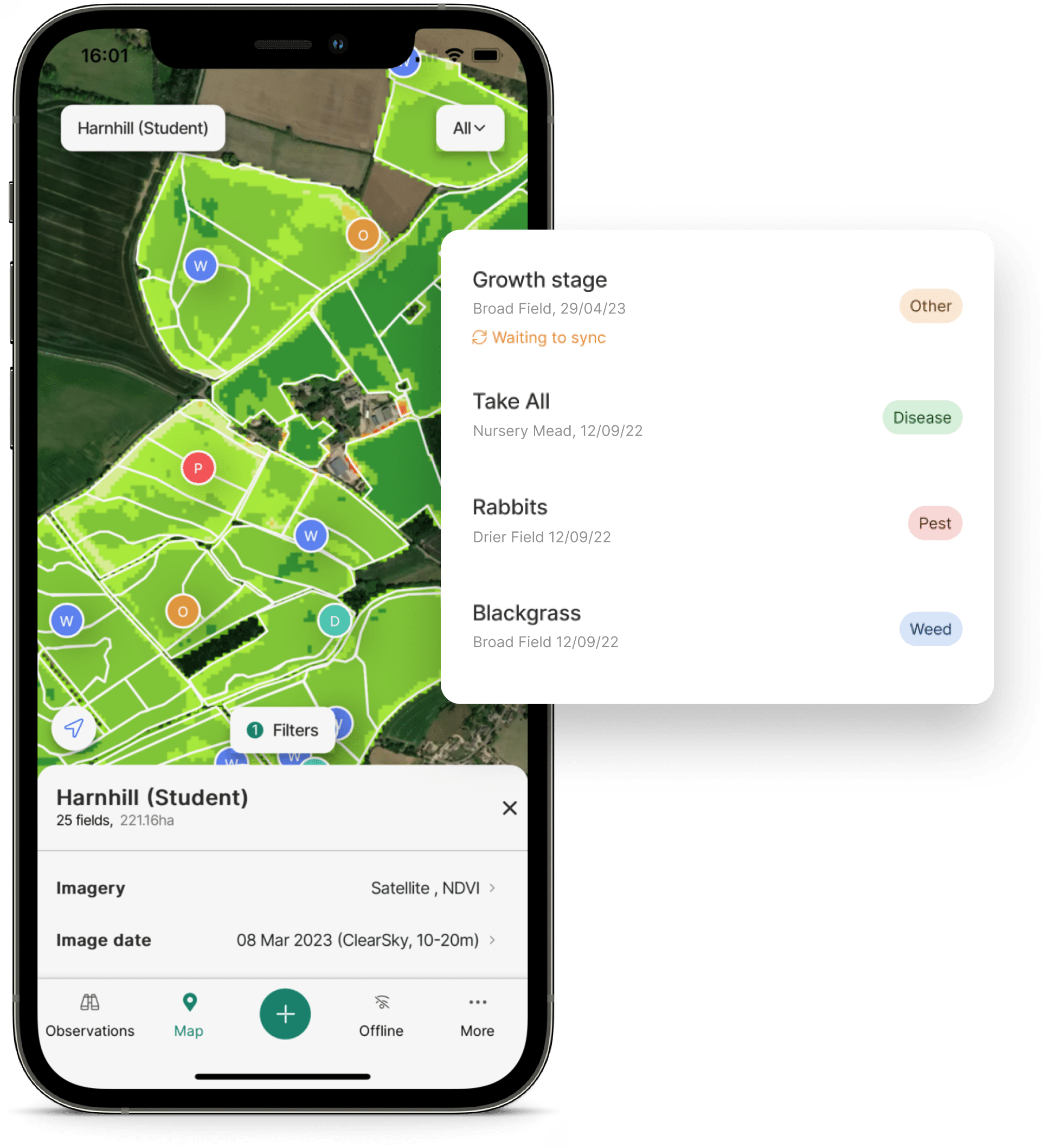
Contour Mobile
Fast, Precise Scouting On-the-Go
Contour Mobile is an award-winning app that connects growers and advisors, enabling quick and comprehensive observation and recording of field issues:
Fully offline capable mobile app enables on-site data collection anywhere, anytime, with data sync to the web platform.
Enables targeted agronomy through geo-referenced scouting and observations.
GPS pinpointed observations for precise issue tracking and photo documentation.
Ability to view satellite imagery in-field allows targeted crop inspections.
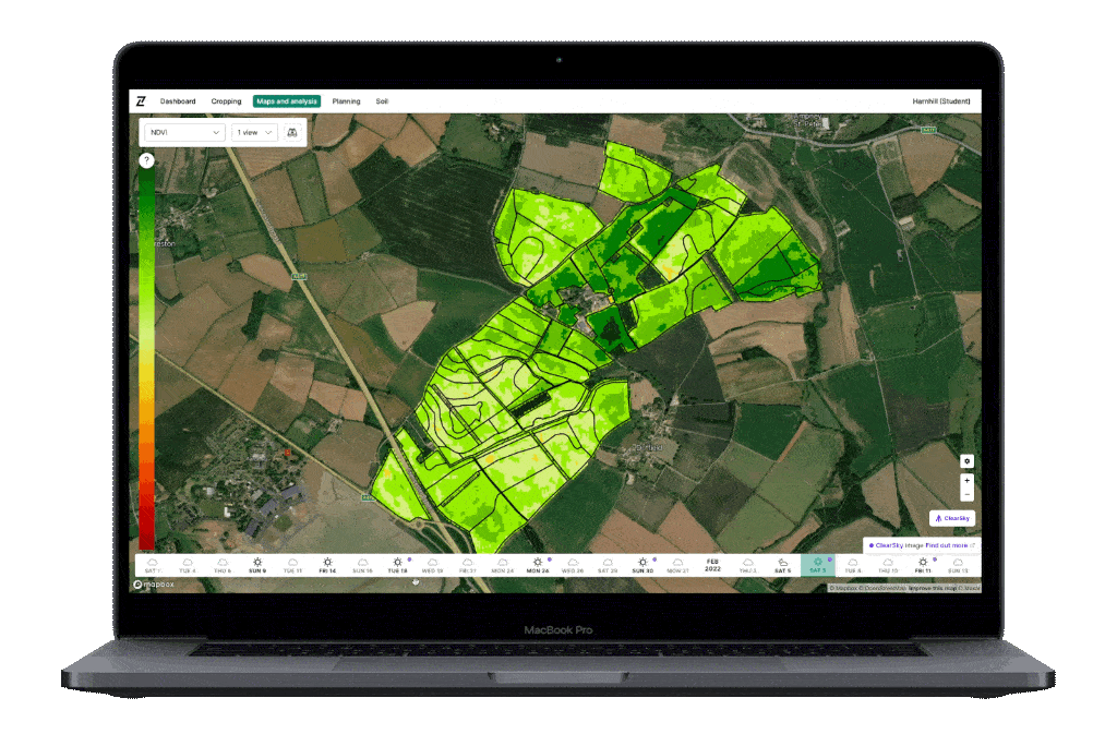
ClearSky Imagery
A Guaranteed Cloud-Free Image Every Week
Next-gen satellite imagery enabling consistent monitoring of crop health, variation, and performance:
Consistent, clear imagery every 6 days, all year round, regardless of weather or cloud cover.
AI-based service that derives full-spectrum optical and infrared imagery, including NDVI and GCVI, from radar (SAR) data.
First AI-derived imagery service of its kind on the market, exclusively available through Origin.
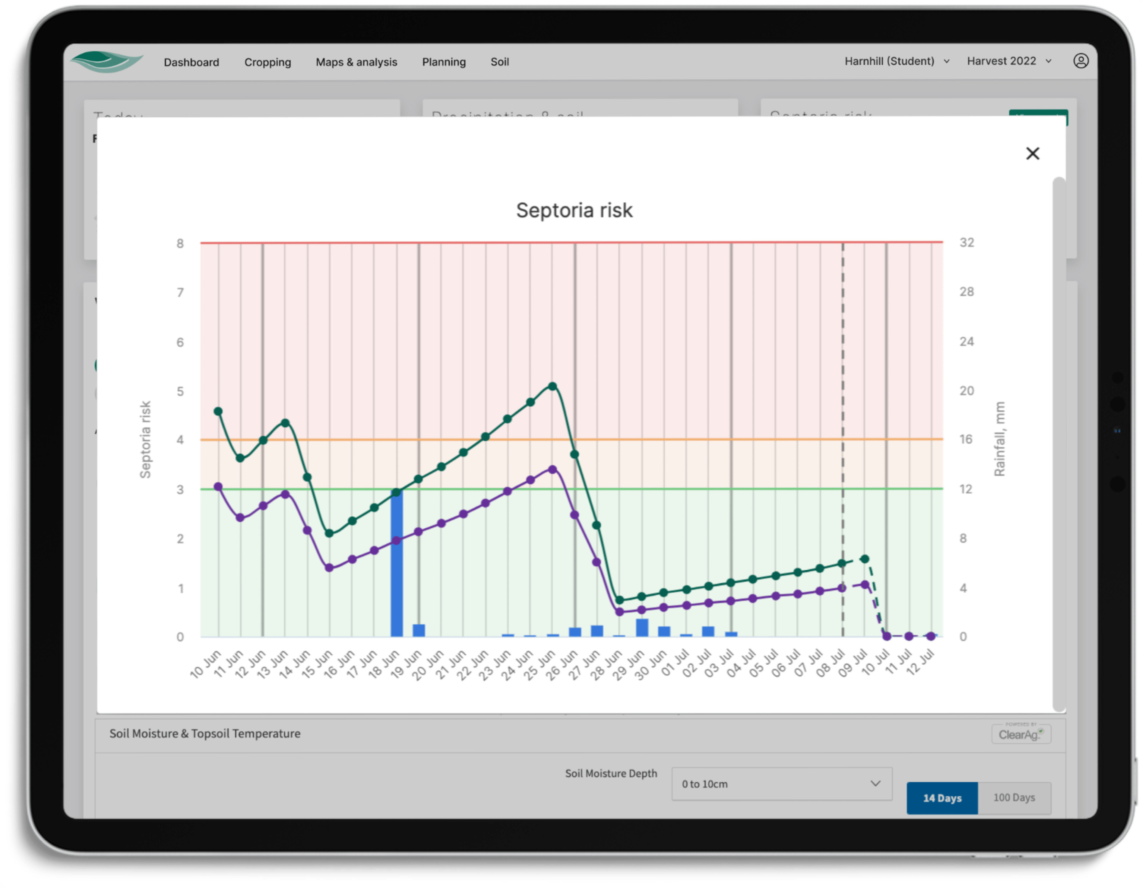
Disease Risk Models
Informing Proactive, Intelligent Crop Management
Advanced models for informed crop protection decisions:
Automatically identify risk levels to make informed crop protection decisions.
Rigorously evaluated through extensive trials across multiple years and locations.
Integration of Origin Group R&D into digital products for advanced pest management.
Access BYDV and Septoria models, with a growing line-up of further models in development.
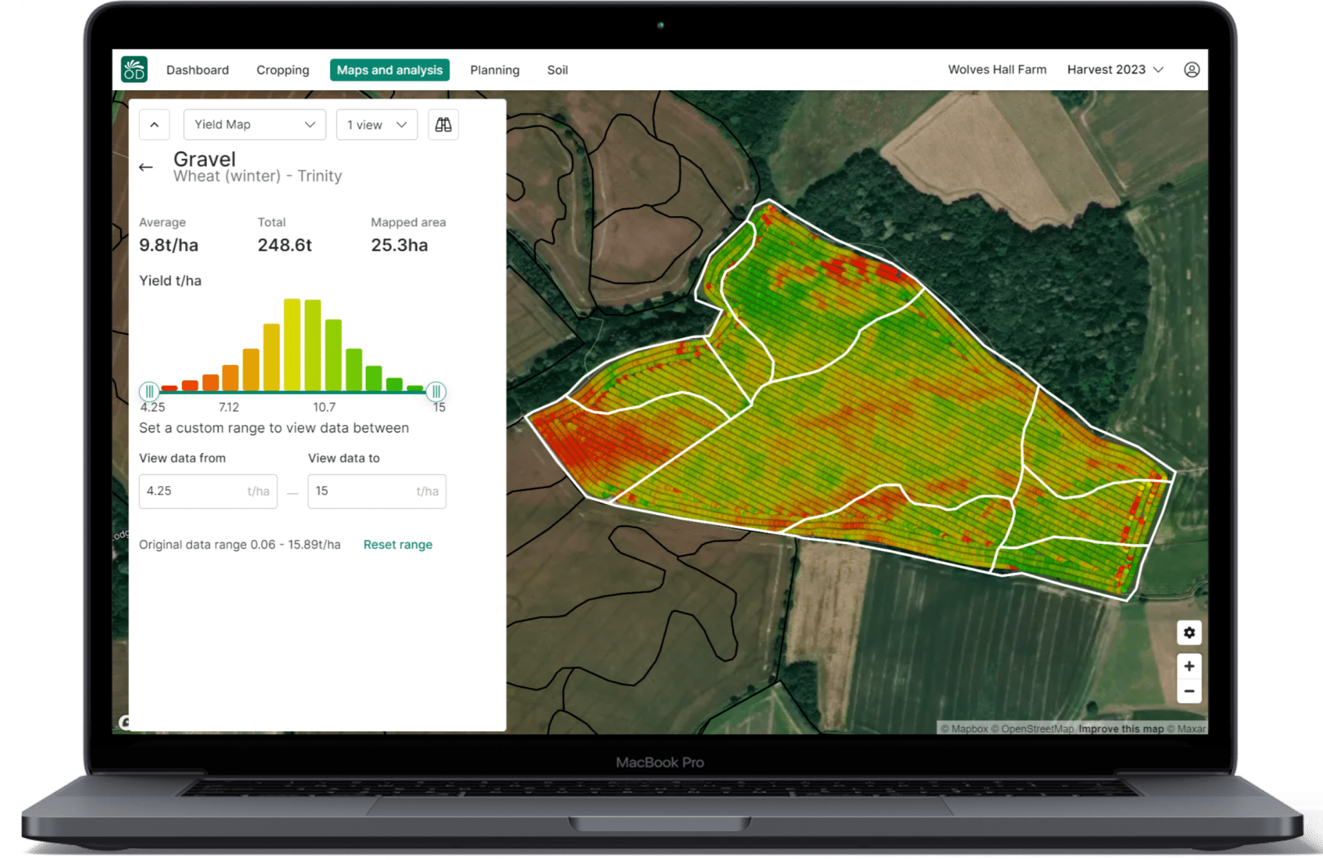
Yield & Soil Analysis
Analyse deeper. Plan better. Perform stronger.
Comprehensive data to evaluate and investigate soil health and yield performance:
View soil physical and analysis data across fields and make side by side comparisons.
See and understand more of what has happened in each field and establish cause and effect for crop variation.
Identify high/low areas of nutrient availability and understand where soils need improving.
Detailed yield distribution data for trend analysis and land performance assessment.
Discover the full potential of Contour’s Agronomy Services tools
Contact us to discover the full potential of Contour’s Agronomy Services tools, and together we can enhance farm performance and sustainability.
